Problem Assessment
Self-outdoor localization of Unmanned Aerial Vehicles (UAVs) lacks accuracy, particularly, close to large structures (GPS-denied), close to metal structures (affecting compass accuracy), or under extreme weather or day/night conditions, impacting its self-navigation.
Current perception systems, such as LiDAR, visual or thermographic cameras and radar, fail under difficult environmental conditions (e.g., fog, glare, or darkness), impairing the effective autonomation of UAVs. Hence, accurate and precise navigation and perception systems are critical towards the full development of autonomous aerial drones and to mitigate air and ground risks.
Technology
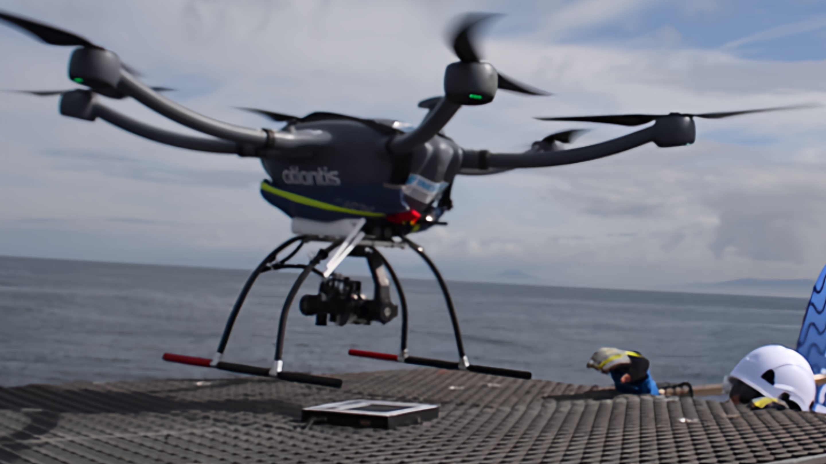
Our solution is ArTuga (Augmented Reality Tag for Unmanned vision-Guided Aircraft), an innovative multimodal fiducial marker for aerial robotics and others, developed to improve the precision landing capability of unmanned aerial vehicles (UAVs) in harsh environments. This technology can also be applied to manned vehicles, as well as marine and land vehicles.
The technology consists of two main components – a multimodal fiducial marker (ArTuga), combining photometric and radiometric data, and a heterogeneous perception system (TriOPS) with a visual and thermal cameras and a LiDAR 3D – combined with a real-time multimodal fusion technique that ensures a robust and reliable detection of the target in severe environments.
ArTuga improves the situational awareness of the vehicles, increasing its detection capabilities and navigational abilities, especially in challenging lighting and weather conditions. Thus, improves UAVs autonomation and operations safety.
Advantages
- Drone precise positioning – enables the vehicle to hover over the desired target and complete its task even in adverse conditions;
- Drone precise navigation – GPS independent system, where the target is identified at a distance of ~15 m;
- Precision and reliable landing/docking, even in adverse conditions and on moving objects;
- Mitigation ground risk – able to perform the landing maneuver without compromising its own safety and the integrity of its surroundings;
- Add-on perception and navigation system with real-time localization even under harsh environmental conditions;
- Dual charging strategy – works with battery or power supply (from the Grid or PV panels);
- Customizable – particularly the pattern and size of the fiducial marker.
Possible Applications
- Onshore and offshore inspection operations (wind farms, photovoltaic panel parks, oil & gas platforms, others);
- Onshore and offshore disaster assessment suport / Search and rescue / Military surveillance and reconnaissance.
- Commercial deliveries (logistics / emergency deliveries, etc);
- Location of docking stations, for both maritime vessels and land vehicles.
-
Commercial Rights
INESC TEC and U.Porto have exclusive rights -
Development Stage
Industrial prototype (TRL 7) -
Further Information
Intellectual Property Status
Opportunities:
- Licensing
- Contract Research
- Product Development
- Industrial Partnership
Demo/Video
Scientific Publications
Rob Auton Syst 163 (2023) 104398
Awards & News
- Portuguese team successfully tests autonomous robots to inspect floating offshore wind farms
-
Industrial Categories
Energy, Sea -
Tags
Computer vision, Cooperative perception, Precision landing, Self-navigation, Fiducial markers, Vertical takeoff and landing (VTOL), Unmanned aerial vehicles (UAV)