Cookies
O website necessita de alguns cookies e outros recursos semelhantes para funcionar. Caso o permita, o INESC TEC irá utilizar cookies para recolher dados sobre as suas visitas, contribuindo, assim, para estatísticas agregadas que permitem melhorar o nosso serviço. Ver mais
Aceitar Rejeitar
  • Menu
Apresentação

Robótica e Sistemas Autónomos

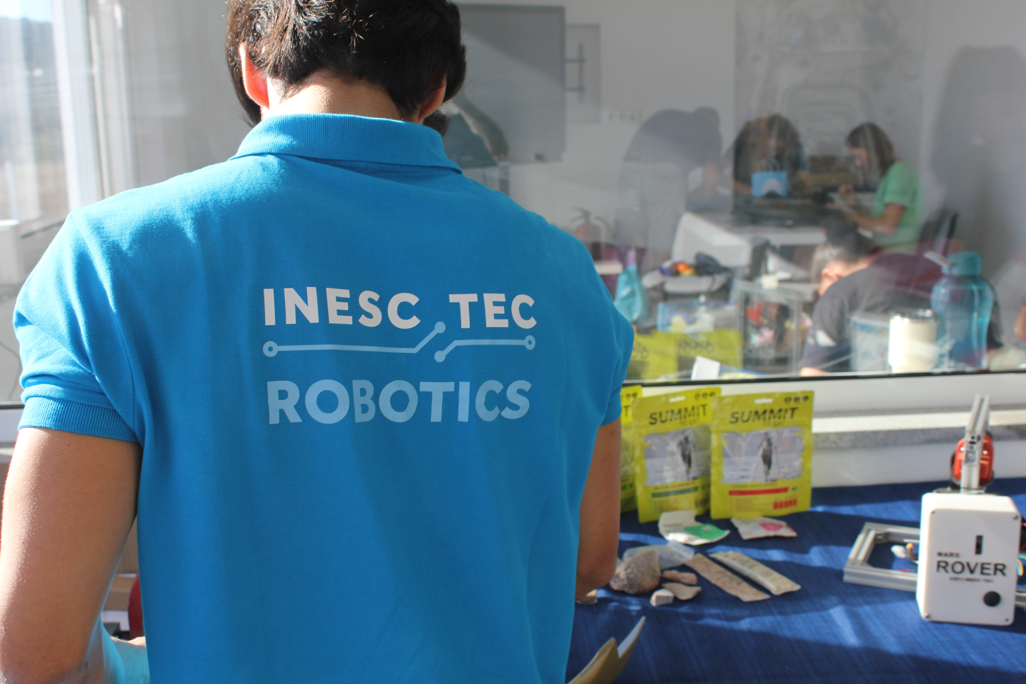
No Centro de Robótica de Sistemas Autónomos (CRAS), dedicamo-nos ao desenvolvimento de soluções robóticas inovadoras para operação em ambientes complexos. No dia-a-dia, os nossos investigadores tentam cartografar o que ainda desconhecemos e, por isso, encontram soluções para explorar as profundezas do mar, monitorizar o meio envolvente, ou inspecionar infraestruturas.


O nosso objetivo? Ser uma referência mundial em robótica e sistemas autónomos, combinando competências em perceção multissensorial e modelação 3D, navegação e controlo, manipulação e intervenção robótica – testando os limites da robótica autónoma e integrando robôs aéreos, terrestres e subaquáticos nas nossas soluções.


Com um foco em níveis de maturidade tecnológica (TRL) 5-8, o CRAS desenvolve protótipos e soluções operacionais para setores estratégicos. A nossa infraestrutura laboratorial inclui tanques de teste, oficinas de prototipagem e uma variedade de equipamentos prontos para operar em ambiente real.


Os nossos investigadores fazem ainda uso do Mar Profundo, um navio de apoio ao teste e validação de tecnologias inovadoras para uso marítimo, uma peça fundamental na interligação entre a conceção teórica e a validação em campo.


O CRAS destaca-se pela sua abordagem prática: combinamos investigação avançada com o foco em aplicações reais, reduzindo riscos humanos em missões perigosas, otimizando operações e processos, expandindo os limites da robótica autónoma.
notícias

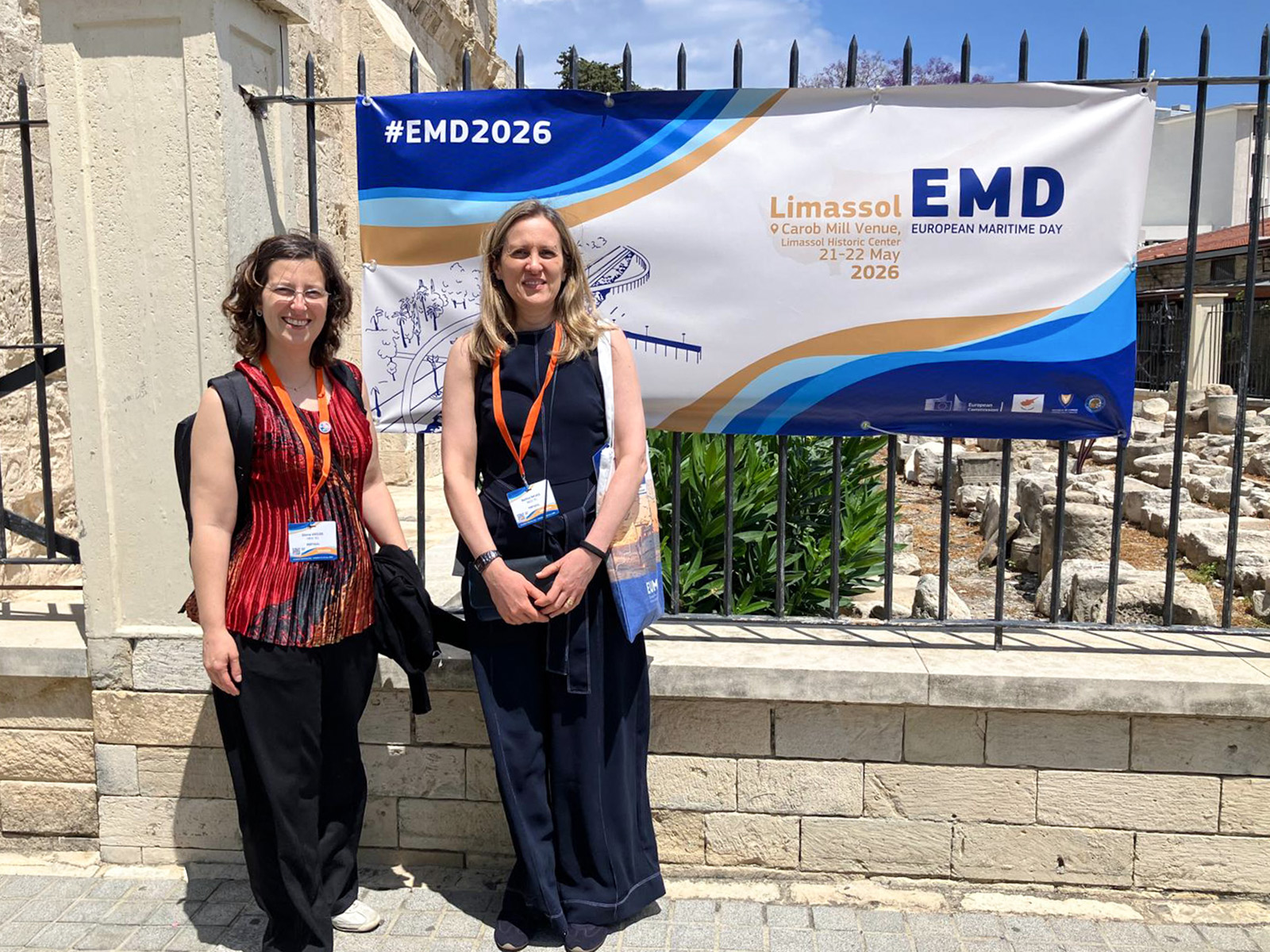
Da segurança à sustentabilidade, INESCTEC.OCEAN levou a inovação tecnológica ao Dia Europeu do Mar

A propósito do European Maritime Day 2026, o Centro de Excelência liderado pelo INESC TEC teve a oportunidade de coorganizar duas sessões de workshop em Limassol, Chipre. Entre a necessidade de maior monitorização e vigilância dos oceanos e a cooperação para um mar sustentável, o INESCTEC.OCEAN contribuiu ativamente com a investigação, experiência e competências do centro para o avanço da Economia Azul.  

30 junho 2026

Robótica

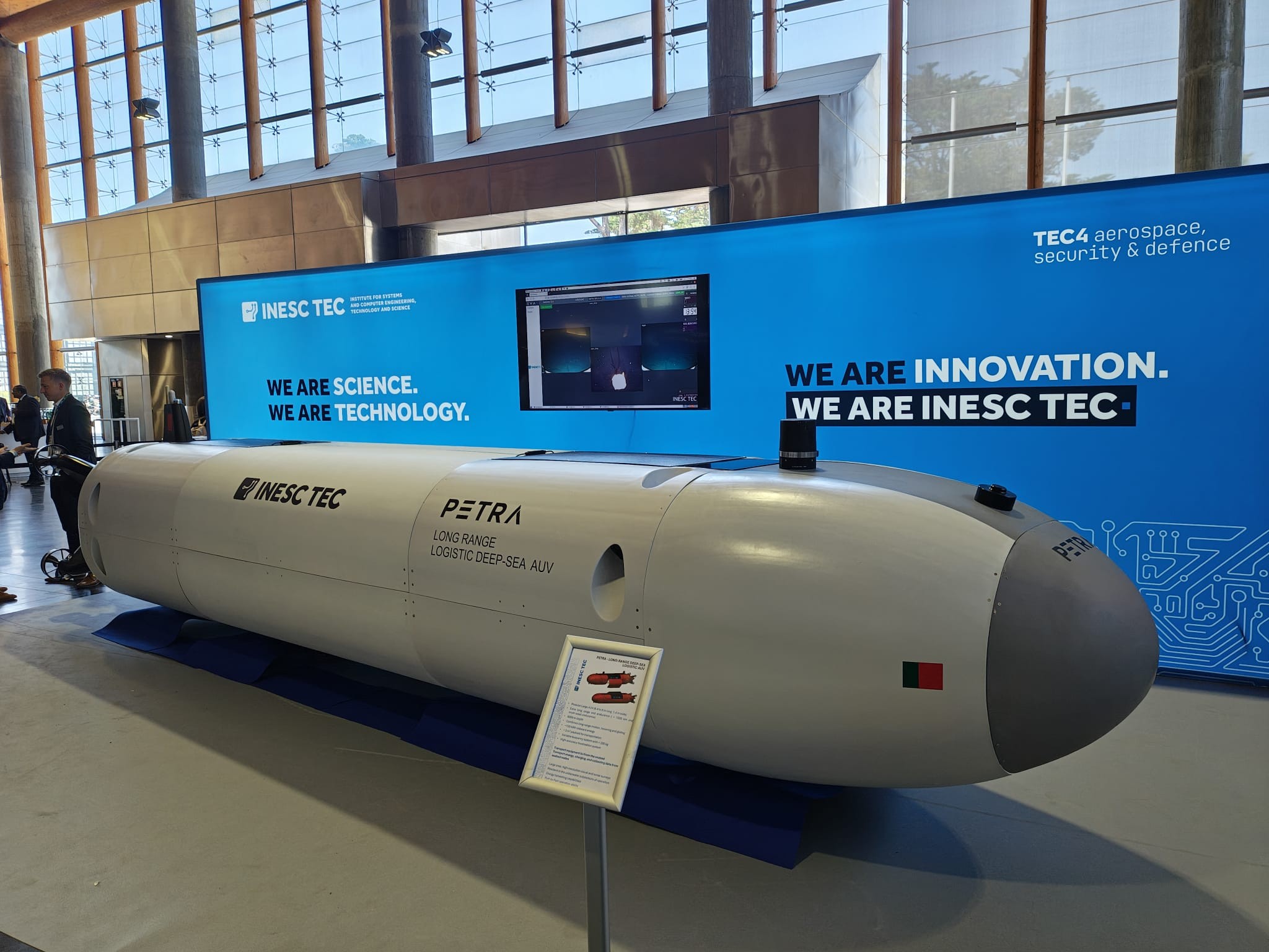
Novo robô desenvolvido pelo INESC TEC vai revolucionar o apoio logístico nas operações do mar profundo

Não existe nada igual no mundo. O protótipo está em desenvolvimento e já tem a primeira missão marcada para maio de 2027, onde permanecerá no fundo do mar durante duas semanas. Mas afinal o que tem de diferente o novo robô autónomo PETRA - Long-Range Deep-Sea Logistic AUV -, desenvolvido por investigadores INESC TEC?

27 maio 2026

INESC TEC lidera desenvolvimento de tecnologia robótica para o mar profundo

O Instituto coordena o projeto europeu DEEP-TECH, apoiado em 11,6 milhões de euros pelo Fundo Europeu de Defesa. O projeto vai desenvolver novas capacidades para plataformas submarinas robóticas e infraestruturas autónomas, integrando tecnologias avançadas de energia, comunicações, sensores e deteção de ameaças. O objetivo é reforçar a permanência, resiliência e a autonomia de operação de sistemas não tripulados em ambientes marítimos de grande profundidade e elevado risco. 

22 maio 2026

Sociedade, Escola e Investigação: INESC TEC ensina estudantes a construir o seu próprio robô

O projeto SEI juntou investigadores e alunos da Escola Secundária Garcia de Orta na criação de um veículo para o mais recente Festival Nacional de Robótica. A iniciativa terminou este mês com a presença na Mostra SEI.ence 2026, na qual o INESC TEC também promoveu um workshop.  

22 maio 2026

Robótica

Como se simula o imprevisível? INESC TEC desenvolve tecnologia para simulação de cenários complexos com recurso a IA

Quando o tempo é pouco e as decisões críticas, ter um sistema de apoio inteligente pode fazer a diferença. E o INESC TEC está a construir esse futuro no âmbito do recém iniciado projeto europeu BATTLEVERSE.

21 maio 2026

Tópicos
de interesse
036

Projetos em destaque

HIFLOW

Hull-Integrated Flow Sensing Matrix for Advancing Inertial Underwater Positioning of Oceanographic Unmanned Platforms

2026-2027

MP_EVA

Mar Profundo para recolhas visuais e filmagens com o veículo autónomo EVA

2026-2026

DSM_IMPACT

TECHONOLOGICAL CONSULTANCY FOR DSM IMPACT

2025-2026

ATLAS

Atlantic Tracking with Lightwave Acoustic Sensing

2025-2028

BATTLEVERSE

A Human-Centred MSaaS Ecosystem for Enhanced Mission Planning and Execution via BATTLEfield Modelling, AdVERSarial AI, and Multi-domain Simulation Environments

2025-2028

PLANKTASTIC

Uma nova abordagem para investigar efeitos dos micropla´sticos no plâncton: dos organismos a`s comunidades e funcionalidades dos ecossistemas

2025-2028

AquaBenefit

Para além da colheita: benefícios ecológicos da aquacultura de bivalves

2025-2028

UPWELLING

Unlocking Potential for Workforce Excellence, Leadership, and Innovation in the Next-Gen Blue Economy

2025-2027

BioPorts

Combining biotechnology and robotics to prevent and eliminate pollution inside ports

2025-2028

VICTORIOUS

INNOVATIVE AI-ENHANCED, REMOTELY POWERED, INDIRECT FIRE OBSERVATION SYSTEM UTILIZING UNMANNED VEHICLES

2025-2028

DigiMaTRIA

DigiMaTRIA - Gestão Digital da Manutenção de Ativos Industriais com recurso a Robótica e Inteligência Artificial

2025-2028

SoleMATES

Sole Monitoring using Automated and Traditional eDNA Sampling

2025-2027

AI4PORTS

AI techniques for anomaly assessment in Port Structures

2025-2026

ADVISOR

Cooperative Missions of Autonomous Vehicle Swarms for Surveillance Tasks

2025-2027

AEROSUB

Automated Inspection Robots for Surface, Aerial and Underwater Substructures

2024-2028

NuClim

Nuclear observations to improve Climate research and GHG emission estimates

2024-2028

BioProtect

ADVANCING AREA-BASED MANAGEMENT TOOLS TO ACCELERATE THE PROTECTION AND RESTORATION OF MARINE BIODIVERSITY ACROSS THE EUROPEAN SEA BASINS

2024-2028

TALOS

roboTics and Artificial intelligence Living labs improving Operations in PV Scenarios

2023-2026

NETTAGPlus

Preventing, avoiding and mitigating environmental impacts of fishing gears and associated marine litter

2023-2026

NMicroARTIC

Nitrogen Microbiome in the Changing Artic

2023-2026

ATE

Aliança para a Transição Energética

2023-2026

TRIDENT

Technology based impact assessment tool foR sustaInable, transparent Deep sEa miNing exploraTion and exploitation

2023-2027

MineIO

A Holistic Digital Mine 4.0 Ecosystem

2023-2026

AIRSHIP

AUTONOMOUS FLYING SHIPS FOR INTER-ISLAND AND INLAND WATERS TRANSPORT

2023-2026

AOWINDE

ATLANTIC OFFSHORE WIND ENERGY

2023-2026

AEROGANP

Creación de un eje transfronterizo de investigación y transferencia de conocimiento en el sector aeronáutico y espacial en la Eurorregión Galicia-Norte de Portugal

2023-2026

SEAWINGS

Sea/Air Interphasic Wing-in-Ground Effect Autonomous Drones

2022-2026

OVERWATCH

Integrated holographic management map for safety and crisis events

2022-2026

NEXUS

Innovation Pact - Digital and Green Transition

2022-2026

NewSpacePortugal

Agenda New Space Portugal

2022-2026

Drivolution

Agenda Drivolution

2022-2026

StoneByPortugal

SUISTANABLE StoneByPortugal: Valorização da Pedra Natural para um futuro digital, sustentável e qualificado

2022-2026

MAGPIE

sMArt Green Ports as Integrated Efficient multimodal hubs

2021-2026

EUSCORES

EUropean - Scalable and Complementary Offshore Renewable Energy Sources

2021-2027

REVACONSTRUCTION

Digital construction revolution

2020-2023

UNEXUP

UNEXMIN Upscaling

2020-2022

Equipa
  • a
  • b
  • c
  • d
  • e
  • f
  • g
  • h
  • i
  • j
  • k
  • l
  • m
  • n
  • o
  • p
  • q
  • r
  • s
  • t
  • u
  • v
  • w
  • x
  • y
  • z
Publicações

CRAS Publicações

Ler todas as publicações

2026

Underwater SLAM and Calibration with a 3D Profiling Sonar

Autores
Ferreira, A; Almeida, J; Matos, A; Silva, E;

Publicação
REMOTE SENSING

Abstract
Highlights What are the main findings? The SLAM method, based on the registration of 3D profiling sonar scans using the 3DupIC method, avoids the construction of submaps and thereby overcomes the limitations of other state-of-the-art approaches. Simultaneous optimization of the trajectory and extrinsic parameters, using the proposed SLAM and calibration method, ensures high accuracy in trajectory and map estimation. What is the implication of the main finding? Direct registration of raw scans supports two distinct applications. On the one hand, it enables pose estimation through odometry. On the other hand, it provides loop-closure constraints for the SLAM process. 3D profiling sonars are highly effective sensors for mapping, localization, and SLAM applications. This demonstration is particularly important as newer, smaller, and more affordable sonars in this category become available, contributing to their wider adoption.Highlights What are the main findings? The SLAM method, based on the registration of 3D profiling sonar scans using the 3DupIC method, avoids the construction of submaps and thereby overcomes the limitations of other state-of-the-art approaches. Simultaneous optimization of the trajectory and extrinsic parameters, using the proposed SLAM and calibration method, ensures high accuracy in trajectory and map estimation. What is the implication of the main finding? Direct registration of raw scans supports two distinct applications. On the one hand, it enables pose estimation through odometry. On the other hand, it provides loop-closure constraints for the SLAM process. 3D profiling sonars are highly effective sensors for mapping, localization, and SLAM applications. This demonstration is particularly important as newer, smaller, and more affordable sonars in this category become available, contributing to their wider adoption.Abstract High resolution underwater mapping is fundamental to the sustainable development of the blue economy, supporting offshore energy expansion, marine habitat protection, and the monitoring of both living and non-living resources. This work presents a pose-graph SLAM and calibration framework specifically designed for 3D profiling sonars, such as the Coda Octopus Echoscope 3D. The system integrates a probabilistic scan matching method (3DupIC) for direct registration of 3D sonar scans, enabling accurate trajectory and map estimation even under degraded dead reckoning conditions. Unlike other bathymetric SLAM methods that rely on submaps and assume short-term localization accuracy, the proposed approach performs direct scan-to-scan registration, removing this dependency. The factor graph is extended to represent the sonar extrinsic parameters, allowing the sonar-to-body transformation to be refined jointly with trajectory optimization. Experimental validation on a challenging real world dataset demonstrates outstanding localization and mapping performance. The use of refined extrinsic parameters further improves both accuracy and map consistency, confirming the effectiveness of the proposed joint SLAM and calibration approach for robust and consistent underwater mapping.

2026

Learning-Based Online Tracking Algorithms for Marine Litter in Multibeam Water Column Images

Autores
Guedes, PA; Silva, HM; Wang, S;

Publicação
IEEE ACCESS

Abstract
Marine litter is a growing environmental threat, with severe ecological and socio-economic impacts. Most monitoring strategies rely on optical sensors to detect surface pollution, however these approaches fail to capture submerged plastics dispersed throughout the water column. Multibeam acoustic imaging offers a complementary solution, but the scarcity of annotated sonar datasets and the high noise levels of acoustic imagery make automated detection and tracking particularly challenging. This study presents a comparative evaluation of deep learning based multi-object tracking (MOT) algorithms applied to water column acoustic data. Pre-trained YOLOv8 detectors were integrated with tracking-by-detection frameworks including BoT-SORT, OC-SORT, ByteTrack, and DeepOC-SORT. Performance was assessed across acoustic frequencies and preprocessing strategies using standard MOT metrics. Results show that adaptive Gaussian thresholding and opening morphology improved robustness at lower frequencies ( 950 kHz and 1200 kHz ), while unprocessed inputs proved more resilient to severe clutter at 1400 kHz . BoostTrack and ByteTrack achieved the most consistent tracking, effectively managing intermittent detections to maximise MOTA and IDF1. In contrast, OC-SORT underperformed, struggling with fragmented sonar trajectories. Furthermore, while efficient Nano models dominated at lower frequencies, Medium models were required under higher noise. These findings demonstrate the feasibility of applying MOT methods to sonar-based litter monitoring. Future work will explore unsupervised learning approaches to leverage intrinsic sonar data structure, reduce annotation needs, and enable scalable marine litter tracking.

2026

Descriptor: Forward-Looking Multibeam—Marine Litter Detection and Tracking Dataset (FLM-MLDT)

Autores
Guedes, PA; Lysak, M; Amaral, G; Martins, P; Almeida, C; Silva, HM; Martins, A; Wang, S; Almeida, JM;

Publicação
IEEE Data Descriptions

Abstract

2026

Mapping Ethics in EPS@ISEP Robotics Projects

Autores
Malheiro, BA; Guedes, P; Silva, MF; Ferreira, P;

Publicação
CRISIS OR REDEMPTION WITH AI AND ROBOTICS? THE DAWN OF A NEW ERA, ICRES 2025

Abstract
The European Project Semester (EPS), offered by the Instituto Superior de Engenharia do Porto (ISEP), is a capstone programme designed for undergraduate students in engineering, product design, and business. EPS@ISEP fosters project-based learning, promotes multicultural and interdisciplinary teamwork, and ethics- and sustainability-driven design. This study applies Natural Language Processing techniques, specifically text mining, to analyse project papers produced by EPS@ISEP teams. The proposed method aims to identify evidence of ethical concerns within EPS@ISEP projects. An innovative keyword mapping approach is introduced that first defines and refines a list of ethics-related keywords through prompt engineering. This enriched list of keywords is then used to systematically map the content of project papers. The findings indicate that the EPS@ISEP robotics project papers analysed demonstrate awareness of ethical considerations and actively incorporate them into design processes. The method presented is adaptable to various application areas, such as monitoring compliance with responsible innovation or sustainability policies.

2026

VIRIATO: Visual-Action Reinforcement Integrator for Actor-Critic with Temporal Observations

Autores
Campanhã, J; Neves, F; Malheiro, B; Pinto, A;

Publicação
IEEE International Conference on Autonomous Robot Systems and Competitions, ICARSC

Abstract
The Visual-Action Reinforcement Integrator for Actor-Critic with Temporal Observations (VIRIATO) is a compact multi-input feature-extractor architecture designed to enable robust visual navigation of Unmanned Aerial Vehicles (UAVs) conducting close-range inspection of photovoltaic arrays. The target task of low-altitude flight over dynamic, visually variable surfaces without privileged information is inherently partially observable. VIRIATO augments stacked image observations with a short history of recent past actions, producing a richer latent state for the Soft Actor-Critic (SAC) agent. Training is performed with domain randomization to expose the policy to diverse lighting, backgrounds and panel layouts. In simulation, VIRIATO yields faster learning and improved sample efficiency compared to a standard image-only Convolutional Neural Network (CNN) feature extractor, achieving lower position and yaw errors and substantially better robustness under image perturbations while retaining high task completion rates. The architecture is intentionally simple and general: it improves temporal awareness without adding complex recurrence, and it could be adapted to other perception-driven robotic tasks. These results demonstrate that integrating historical action data with visual encoding, together with domain randomization, is an effective way to achieve reliable autonomous vision-based navigation. © 2026 IEEE.